![]()
![]()
|
Expedition Sandwich islands |
||
|
What does this two places connects? Avebury henge and South Sandwich island. |
||
 |
That's what we would like to find out on the expedition to South Sandwich islands. |
 |
|
It all started a long time ago when i got interested in ancient civilizations. And Avebury stand out amongst the other ancient sites in the world. And there is no certainty about the age of this monument. Only date we can obtain is from archeologic surveys that can be carbon-dated. There is a lot of hypothesis about the Avebury and the orthodox scientist are teling us, that it was constructed by the Neolithic man, around 2600BC. |
||
|
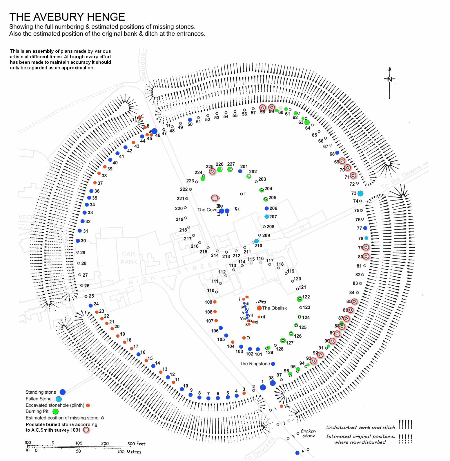
AVEBURY brief history and few facts
I can only add. I would like to see the site rebuild. There is a lot of similar sarcen stones in the vicinity. The very same the builders used. And instead of concrete plinths we should use the real stones. (You can read more about Avebury on Wikipeda and Avebury-web)
|
||
|
|
||
|
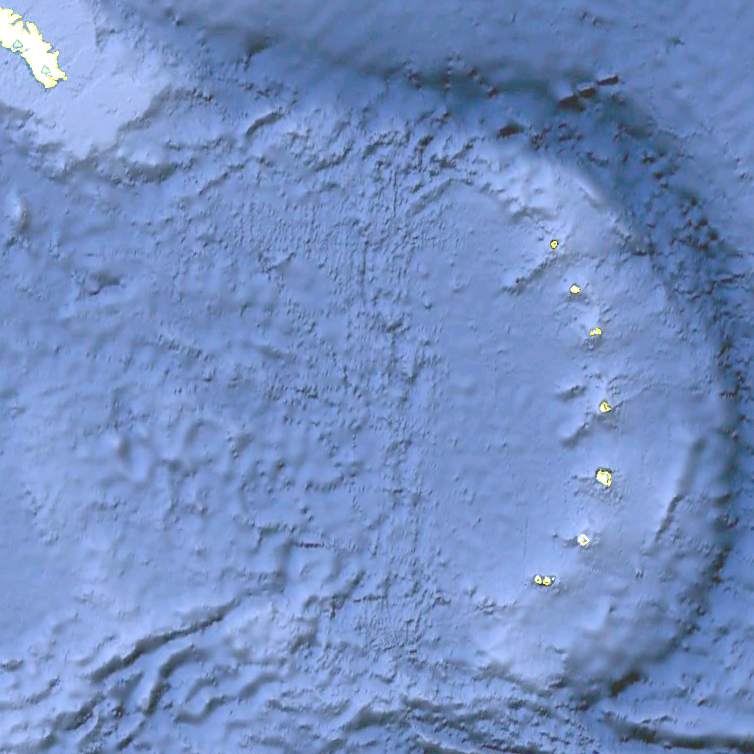
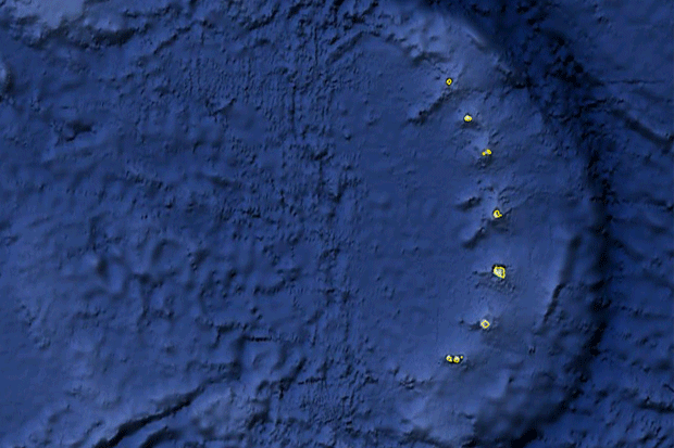
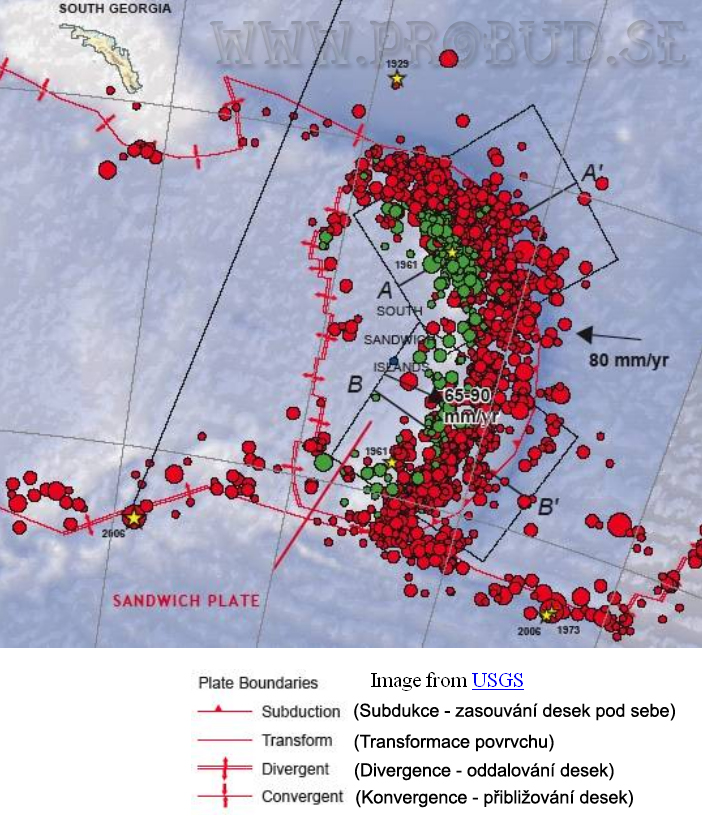
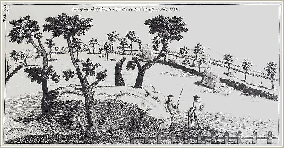
So now to the main reason for this expedition The picture above is a first hint. |
||
|
I spent a long time on fitting avebury diagram over this particular area in south Pacific. (You can try it for yourself in Googl earth). Or you can see the results further down the page. Many people can argue, that the two pictures does not fit perfectly. Yep even i have a little problem with it. Unfortunately the islands lay on a sandwich plate and the whole area is very seismic active. And all the island are volcanoes. Some of them still active from time to time. So only in last 5000 years the islands and underwater mountains could drift by 5-10km (3-7mi). That would be, by the age the scientist gave us (2600BC). If we would think in a bigger picture. That the Avebury could be older than that or when the islands was inhabitable for the last time. We would have to move further into the past and also physicall shift of the islands on the map could be much bigger than 10km (7mi). And that is why the two pictures does not perfectly correspond with each other. |
||
|
Next came the question. It's a circle, but it is not perfectly round. Does it mean something? There is not only one picture (one reason) to build monuments like these. Someone put a lot of effort into it. And i could not help myself to see a faint signature of Thoth over Avebury.
It's hard to believe, that the builders of this stone circle were not able, if they wanted to, to construct a perfectly round circle. Stonehenge or inner circles in Avebury as vell as other henges all around England are perfect circles. I could go to a field behind my house and make a perfect circle with a pole and piece of rope (will have to be a bit longer 166m (544ft)). So if the architect wanted it to be a perfect circle, then no doubt he would make it like that and not a potato shape as it is.
Also bunch of neolithic men moving stones up to 120tons is for me a hardly believable idea.
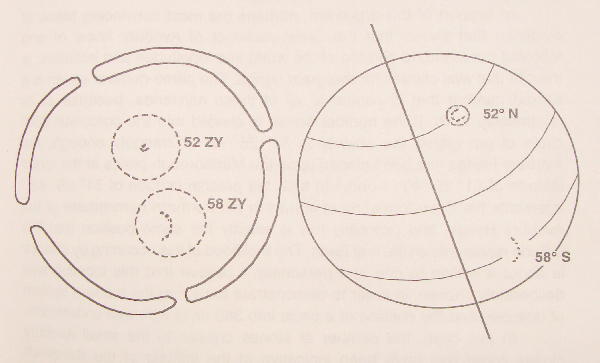
As you can see from next picture Avebury resemble planet Earth with tilted axis approx 23°, flattened top and botom and equator. And by my opinion it also pictures the exact geographical location in south pacific. (animation below)
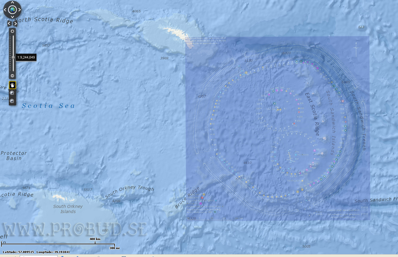
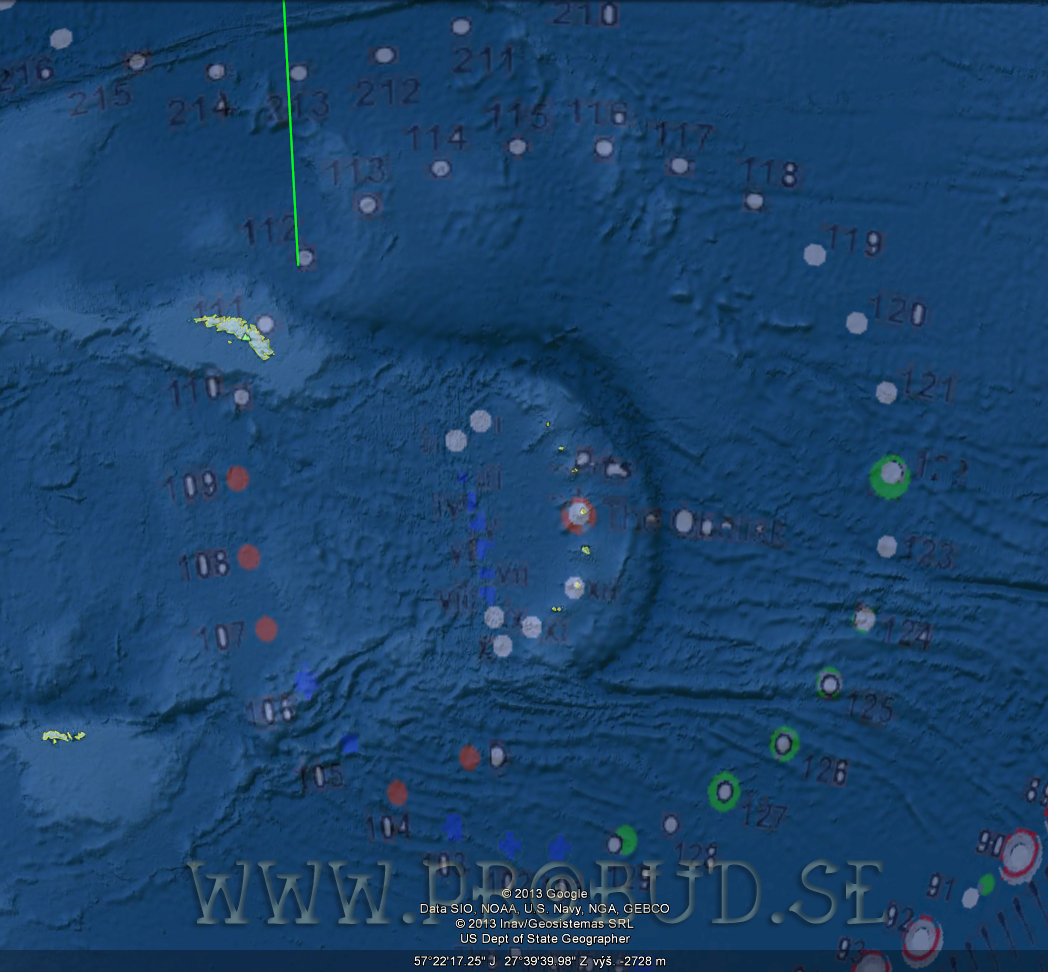
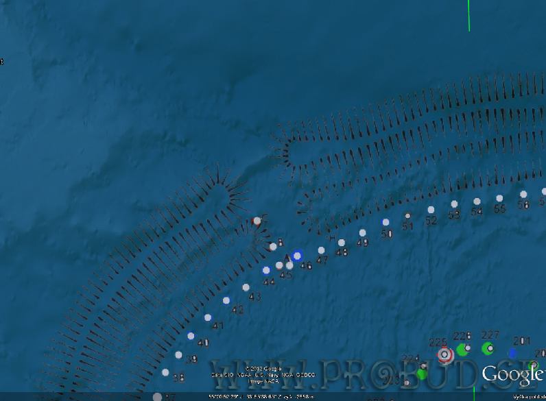
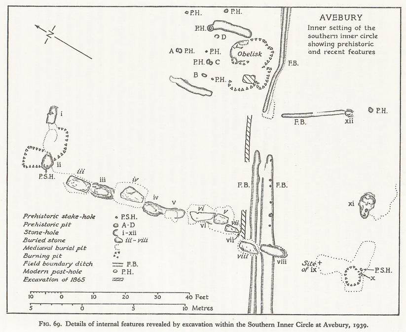
I went further and enlarged the diagram even more and then the stones in the south circle fit over the Sandvich islands (pictures at the bottom). The largest stone on the site "The Obelisk" marks the position of Saunders island. And the straight line of stones know as "Bench" ( i-x ) resemble underwater mountains where two tectonic plates are pushed apart from below (detail of excavations in southern circle 1939.) Next detail is from northern part of the circle, where underwater peaks correspond with the stones A,B,C. And between the outer bank is a strange mountain pass or ridge, which looks like blocking the entrance. Also there are always new crop circles appearing in the fields around Avebury, Check the goolge Earth and you can spoot at least three there close to Avebury. So maybe somoene else is pointing something out for us.
|
||
|
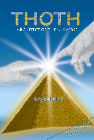
Next proof for my theory i found recently in the book by Ralph Ellis - Thoth Architct of the universe.
In this book the author takes a closer look on Avebury. He used unique measurement system based on the sacred geometry of megalithic sites and Pyramids of Giza. He as a firt person i know, that claimed that the Avebury is actually a map of the Earth. And by his calculations i got exact latitudes. (picture on the right ) We can easily check up the righteousnes of the north circle. As it is not far away. It resemble in its shape the cenral stones in the Stonehenge (stones I,II,III). Unfortunately the other site would be a little problem to verify as it is in the Antarctic region. |
|
|
|
|
The diagram and cover is used with personal permission from Ralph Ellis. And i am in contact with him. He is very interested what we could find there. But unfortunately he has a full schedule for the time of the expedition, Otherwise he would join us onboard. © Ralph Ellis 1997 |
|
|
|
||
|
In my opinion this island could have been be once inhabited in the past vhen the climate was more friendly. And in that case there could be something waiting to be found. Best option we hope for would be something like Pompeii or Herculaneum. Where the time stopped at the moment of volcano eruption. In that case we would have the exact date for the incident. Directly from the remains and indirectly from the ashes scattered round the globe by the eruption. And as the islands are volcanoes there is a high probabilty of this option. Middle option: There will be just some remains of ancient structures, or some artifacts. Or some remains underwater. The worst option: There is nothing to be found anymore maybe it was destroyed by the natural forces. Or maybe i am a fool and there was nothing at all ever. But in face of all the evidence i believe there was something in the past. I don't know what, but there is no other way to find out, than to get there and dig. Because there is no regular connection or anything going close to the islands. We would like to join the expedition, which is already planned for november 2013. To plan such an epedition from scratch would be much more difficult, than to join somone going in that direction. In this case we will have 2-3days for exploration of the islands. It all depends on how much funds we can collect. On that will depend the number of members of the expedition. If we will be able to send 5 or more persons, then the change in the ships route can be made. To suit better our plans. And also we coud bring more scientific equipment for the research. As well as scannig, or even sending an underwater camera down to bottom while we will float over the outlines of the Avebury in the ocean. We would like to send 1-5 people on this expedition. Myself as an organizator. And we got confirmed the participation of czech egyptologist Jaromír Kozák and author of the books as: Translation of Egyptian book of the Dead, Textbooks of Hyeroglyphs, books of IEOU, Pistis Sophie etc.. The third and fourth member are not yet confirmed. Of course the more money we could rise the more members could come to expedition. Everything is up to people willing to sponsor this cause.
Price for one member of the expedition is approcx. 250 000,-CZK (10.000€, 14.000$). Compred to send our own expedition this price is negligible. I am willing to work on the ship to save the funds for another person, or if we do not reach the needed funds. I already send my CV to the organizer of this Trip. So maybe i can get a job onboard the vessel. |
||
|
Enlearged south circle fits almost perfectly in the area. With obelisk pointing at Saunders Island |
|
|
|
|
||
|
We are all on the same boat and to this place you can get only by boat. That is one of the reasons i created this page to ask for help in this project. Because if we could find something significant. It could easely change the view on the origins of the civilization. And maybe show to all unbelieving Thomases. "Hey somoene was here, we are not the best civilizition which was walking on this planet."
|
||
|
As said one great nonexistent Czech genius Jára Cimrman (Czech joke): "You can disagree with me, you can dislike it. But that's rougly all you can do about it." And i can add to it: You can think i am crazy fool or a loony. Same as many people before, which was like me. Whom got nothing but the laugter until they found something or made some discovery, invention or scientific breakout . Tak a city of Troy for example, no one believed it existed, and then one man believed to old tales and legends. And found not only one Troy, but beneath was even older one. So i hope i atleast put a bug in your head. And in the best you would like to support this project. I don't know what could be found there, if something or nothing at all. Even if someone else found it, not me i do not care as long as it is uncovered. What i care about, is the possibility to find something that important. Its mainly about the choices we make.
|
||
| contact: info(@)probud.se : info(@)djbazar.cz : |
|
|
|
Organizers and main Sponzors |
|

| Media partners | |||
|
|
|
||

| Sponsors | |||||
| Renata Slámová | David Ublanič | ||||


Pokud chcete ocenit naši práci, můžete ZDE